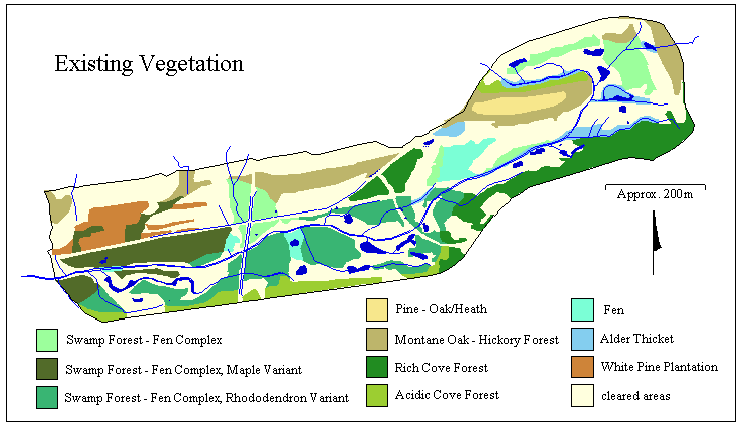
Figure 1. Vegetation
Tulula Creek Mitigation Bank: Using GIS to Guide Wetlands Restoration
Spatial Data and GIS in Western North Carolina |
Part of the overall mission of the Tulula Wetlands Research Program at the University of North Carolina at Asheville is to provide GIS/GPS research and educational opportunities for undergraduate students.
| Our initial efforts have focused on developing a vegetation classification for the site, using a combination of photo-interpretation, field survey, and CAD drawings of the golf course design provided by NCDOT (Figure 1). This classification, which largely follows NCNHP's Classification of the Natural Communities of North Carolina,(Shafale and Weakley 1990), is continually updated in the GIS through photo-interpretation, to represent successional changes at Tulula Creek. |
Figure 1. Vegetation |
| Forty-nine groundwater monitoring wells and 20 pieziometers have been installed at the site, and have been monitored weekly since 1995 (Figure 2). We have used these data to model the seasonal patterns of groundwater levels, by generating interpolations of groundwater levels using Arc/Info's GRID utility. We have also used GRID to examine correlations between well readings and topographic attributes (slope, aspect, surface flow accumulation), to identify those features most influencing local hydrology. |
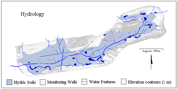 Figure 2. Hydrology |
| Students at UNCA have been working with the Tulula GIS database to broaden their understanding of ecological processes. In one study, the potential distributions of several species, including the meadow jumping mouse (Zapus hudsonius) (Figure 3), have been determined by identifying appropriated habitat, barriers to dispersal, and connectivity corridors. These studies can be used to guide restoration activities and revegetation design, to ensure the fullest possible resource availability to wildlife within the site. |
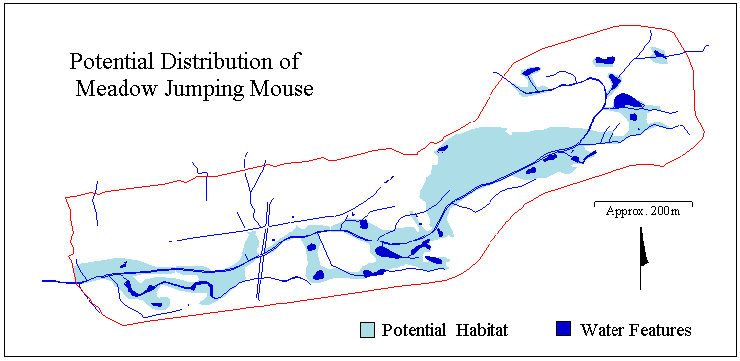 Figure 3. Mouse Habitat |
| As part of a broader study of avian richness and diversity on the site, we are currently focusing on territory selection by a neotropical migrant species, the golden-winged warbler (Vermivora chrysoptera) (Figure 4). We have located 10 current warbler territories at Tulula Creek using field survey and Global Positioning System (GPS) to map perch sites. From these mapped territories, we are collecting information concerning warbler habitat preferences, including type and arrangement of vegetation and proximity to water sources. |
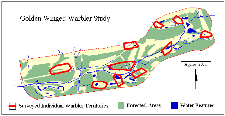 Figure 4. Warbler Study |
| Community Contacts |
| Stephanie Wilds Blue Star Consulting 828-669-9718 Kevin K. Moorhead 828-251-6441 Fax: 828-251-6041 University of North Carolina at Asheville Asheville, NC 28804 |