![]()
![]()
![]()
Links to Other Sites
TYPE-B
|
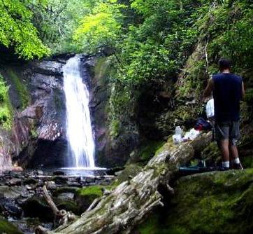
I amble. I mosey. I lollygag. I do, however, like a strong and planned hike when i can. For that i have the dynamo known as Ed. Ed's a perfect compliment to my type-B personality. He plans a hike with an exactness rivaling a military insertion into enemy territory. Well, ok, he's not that anal, but he is ex-military, and prides himself on his preparedness. He also takes my ribbing well. |
|
|
HIKE INDEX The hikes listed below are really expanded notebook notes; they just have a beginning and an end. Unlike my constant rambling. Not to mention sentence fragments. Even though i have personally hiked many area trails, i'm only going to detail trails that i have annotated and photographed, in order to give a decent accounting of the hike. All of the hikes detailed so far are in the Pisgah National Forest. I'm not going to assume you know how to hike and be prepared, such as with first-aid, bee-sting/snake-bite kits, water and someone knowing your itinerary, etc., etc., so i won't go into all that here. There are other good sites for the details of hiking, listed in the Links section, or check Peak to Peak for articles or other hikes. | |
COMMENTS
The little pictures in the Comment field below are shorthand ways of saying:
|
|
The trail is a loop and you will not have to retrace your steps to get back to the beginning, or a small amount of retrace. |
|
|
The trail is a 'one way' trail. You will either have to go back the same way, or, where noted, you can return by walking along a road. |
|
|
|
|
|
The trail is also an approved bike trail. This doesn't mean to avoid it as a hiker, but please be aware of, and courteous to, others on the trail. |
|
|
The trail can be crowded, especially during peak times (non-winter weekends). |
|
|
The trail can be muddy during, or after raining. A lot of trails cross creeks, but it's only when it's particularly muddy. Bad if in combination with the bike. |
|
|
The trail can be windy. Make sure to have a jacket even on hot days, and bundle up on cooler/cold days. It can get to you quickly. |
|
|
|
|
|
The trail is particularly spectacular in spring. This is true for most waterfall trails - when the water's up - but others also. |
|
|
The trail is a great summer hike, usually denoting that it's an area that tends to be cooler during summer's hotter days. |
|
|
The trail is a great autumn hike. Either spectacular leaves, or some other autumn feature. |
|
|
The trail is great for winter hiking. These trails may easily be followed in snow and fallen leaves while other trails may be somewhat obscured. |
|
Trail Name |
Length |
Difficulty |
Comment |
|---|---|---|---|
|
|
|
| |
|
|
|
| |
|
|
|
| |
|
|
|
| |
|
|
|
|
|
|
Trail Name |
Length |
Difficulty |
Comment |
|---|---|---|---|
|
Shut-In
Trail |
|
|
|
|
Coontree
Loop |
|
|
|
|
|
|
|
|
|
|
|
|
|
|
Trail Name |
Length |
Difficulty |
Comment |
|---|---|---|---|
|
|
|
| |
|
|
|
| |
|
|
|
| |
|
|
|
| |
|
Yellowstone Prong |
|
|
|
|
Graveyard Fields Trail |
|
|
|
For other Western North Carolina hikes, check my Links/Hiking page.

Member of Peak to Peak Trail and Wilderness Links
![]()